QGIS is a professional GIS application that is built on top of and proud to be itself Free and Open Source Software (FOSS).
The QGIS Desktop Application is currently available for Windows, Mac, Linux, BSD and Android, but QGIS is also available as a spatial file browser, a server application, and web applications.
Using GBIF-mediated occurrences in QGIS
GBIF-mediated occurrences can be imported directly from the GBIF API into QGIS using the GBIF Occurrences plugin.
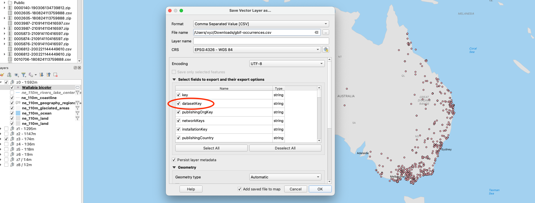
When using GBIF-mediated occurrences, please make sure to export the features of the vector layer as a CSV:

The exported CSV should include (at least) the datasetKey column. This will allow you to create a citable record (derived dataset) with a unique DOI to ensure compliance with the GBIF Data user agreement.